Page Content
- Classification
- Region
- Group
- Latest events
- Taxa, synonyms
- Bibliography
- Figures
- Collection
Polymitoleiopus sandersoni
Polymitoleiopus sandersoni is the scientific name of a group -also called lamiines or flat-faced longhorned beetles-
Polymitoleiopus sandersoni (Gilmour, 1963)
E.F. Gilmour is the author of the original taxon.
The type specimen used for original description is cited from Puerto Rico.
Polymitoleiopus sandersoni (Gilmour, 1963) is the full name of the group-species in the taxonomic classification system.
The species is combined with the genus Polymitoleiopus ranked in the tribe Acanthocinini.
Classification
| kingdom | |
| Animalia | |
| ~1,200,000 sp. | |
| phylum | |
| Arthropoda | |
| ~1,000,000 sp. | |
| class | |
| Insecta | |
| ~830,000 sp. | |
| order | |
| Coleoptera | |
| ~350,000 sp. | |
| family | |
| Cerambycidae | |
| ~35,000 sp. | |
| subfamily | |
| Lamiinae | |
| 22,137 sp/ssp. | |
| tribe | |
| Acanthocinini | |
| 2,279 sp/ssp. | |
| genus | |
| Polymitoleiopus | |
| 147 sp. | |
| species | |
| sandersoni | |
Region
World [1]

Distribution for Polymitoleiopus sandersoni
Group
sandersoni [1]
Subgroup of
Latest events
-
2024 • Polymitoleiopus sandersoni (Gilmour, 1963) • cf. Bezark, L.G. & Santos-Silva, A.
Taxa, synonyms
2 taxa refer to Polymitoleiopus sandersoni
-
Urgleptes haitiensis Gilmour, 1963 [ type locality : Hispaniola, Haiti, Furcy ]
-
Urgleptes sandersoni Gilmour, 1963 [ type locality : Puerto Rico, Bosque Guanica ]
Bibliography
Some citations found in the bibliography excluding lists and catalogs except with nomenclatural act or image or data
-
Urgleptes sandersoni Gilmour • Stud. Fauna Curaçao • 1963 • 17 (76) : 79 [ nov loc ill div ]
-
Urgleptes haitiensis Gilmour • Stud. Fauna Curaçao • 1963 • 17 (76) : 82 [ nov loc ill div ]
-
Urgleptes haitensis ; Chemsak & al. • Univ. Nac. Auton. Mexico • 1992 : 148
-
Urgleptes sandersoni ; Lingafelter & Micheli • J. N. Y. Entomol. Soc. • 2004 • 112 (1) : 51 [ loc ]details
Urgleptes sandersoni ; Lingafelter & Micheli • J. N. Y. Entomol. Soc. • 2004 • 112 (1) : 51
Distribution
- Puerto Rico : Cambalache ; Maricao ; Guajataca ; Ponce ; Rio Abajo ; Susua ; Toro Negro ; El Yunque
-
Urgleptes sandersoni ; Chalumeau & Touroult • Pensoft Publ. • 2005 : 186, 189 [ loc plh ill div ]details
Urgleptes sandersoni ; Chalumeau & Touroult • Pensoft Publ. • 2005 : 186, 189
General information
- distinctive characters
- black and white drawing, part ; color photo, ♂
- host plant
Distribution
- Vierges Is., Anegada I.
- Vierges Is., Guana I.
- Vierges Is., Peter I.
- Vierges Is., Sainte-Croix I.
- Vierges Is., St. John I.
- Vierges Is., St. Thomas I. : Charlotte Amalie
- Vierges Is., Tortola I.
- Vierges Is., Virgin Gorda I.
- Puerto Rico
-
Urgleptes sandersoni ; Ravin & Lingafelter • ZooKeys • 2015 • 532 : 60, 83 [ loc plh ill div syn ]details
Urgleptes sandersoni ; Ravin & Lingafelter • ZooKeys • 2015 • 532 : 60, 83
General information
- description ; distinctive characters
- color photo, part ; color photo ; ...
- synonymy
- host plant
Distribution
- Dominican Republic : Barahona Prov., 11 km S Barahona ; Rd to Polo, S slope, 860m; 4.5 km S Barahon; Paraiso Río Nazaito, 18°00'N, 71°06'W; Filipinas, 625 m, 18°07.339'N, 71°07.152'; El Cachote, 970 m, 18°03.295'N, 71°09.778'W; Rd to Filipinas, 1700 ft ; Dajabón Prov., El Pomo Loma de Cabrera, 366 m, 19°26'09.3''N, 71°34'45.3''W; Los Cerezos, 14 km NW of Río Limpio, 608 m, 19°18'42.9''N,71°36'36.6''W ; Elías Piña Prov., Sierra de Neiba, 1.5 km E of Military Post 204, SW of Aniceto Martinez, 1597 m, 18°41.644'N, 71°46.457'W; Río Limpio, 867 m, 19°14'03.9''N, 71°31'00.9''W ; Hato Prov., Parque Nacional Los Ha?tises, 6 km SW Sabana de la Mar, 1020 m, 19°03.494'N, 69°27.302'W ; Independencia Prov., Rd 47 between Los Pinos and Ángel Félix, 760 m, 18°36.986'N, 71°46.556'W ; La Altagracia Prov., Parque Nacional del Este, Guaraguao, 05 m, 18°19.568'N, 68°48.500'W; Parque Nacional del Este, Boca de Yuma, 20 m, 18°21.508'N, 68°36.956'W; El Verón, Hoyo Azul, 2540 m, 18°33.610'N, 68°26.881'W ; La Altagracia Prov., Parque Nacional del Este, Boca de Yuma, 20 m, 18°21.508'N, 68°36.956'W; Punta Cana near Ecological Reserve, 05 m, 18°30.477'N, 68°22.499'W; Parque Nacional del Este, valle de la Orqueta, 25 m, 18°22.945'N, 68°46.631'W ; La Vega Prov., vicinity of Manabao; 10 km E Constanza, 1295 m; 1 km NW Manabao; Pico Duarte Trail, Ciénaga to Los Tablones, 19°08.222'N, 70°27.736'W ; La Vega Prov., Parque Nacional José Armando Bermúdez, 10 km along trail W of La Ciénaga near Los Tablones, 9901100 m, 19°01.753'N, 70°54.654'W ; La Vega Prov., Rancho Baiguate Hotel, 527 m, 19°07'36''N, 70°38'39''W; 9 km NE Jarabacoa, 2000 ft; Boca de Yuma entrance, Parque Nacional del Este, 12 m, 18°201.904'N, 68°37.094'W; 6 km E Jima, 4100 ft; 10 km NE Jarabaco; 2 km E Tireo, 4100 ft ; Monseñor Nouel Prov., 19°01'N, 70°31'W ; Monte Cristi Prov., Reserva Cientifica Villa Elisa, 183 m, 19°44'46.1''N, 71°15'27.3''W ; Pedernales Prov., 1920 km N Cabo Rojo, 375 m; N of Pedernales border Rd, Río Banano, S of Arroyos, 18°09.291'N, 71°45.540'W; Parque Nacional Sierra de Baoruco, Las Abejas, 1240 m, 18°09.023'N, 71°37.387'W; ... ; Peravia Prov., 5 km W of Rd to El Río, S of Pedregal, 52 m, 19°05.092'N, 70°35.864W' ; Puerto Plata., Reserva Cientifica Isabel de Torres, 704 m, 19°45'55.6''N, 70°42'42.8''W; S of Punta Rusia, 39 m, 19°49.32.5''N, 71°13'11.1''W; S Pico Isabel de Torres, El Cupey Rd, 258 m, 19°45.214'N, 70°43.6464'W; ...
- Haiti : Dept. Ouest., Morne Guimby, 22 km SE FondsVerrettes, 6500 ft. ; Dept. Sud- Est., Massif de la Selle, Morne dEnfer, 1850 m; Parc National La Viste, 1 km S Roche Plat; Furcy
- Puerto Rico
-
Urgleptes sandersoni = Urgleptes haitiensis ; Ravin & Lingafelter • ZooKeys • 2015 • 532 : 60 [ ill ]details
Urgleptes sandersoni = Urgleptes haitiensis ; Ravin & Lingafelter • ZooKeys • 2015 • 532 : 60
General information
- color photo, part
-
Urgleptes sandersoni ; Devesa & Barro • Les Cahiers Magellanes • 2019 • n.s., 33 : 68 [ div ]details
Urgleptes sandersoni ; Devesa & Barro • Les Cahiers Magellanes • 2019 • n.s., 33 : 68
General information
- distinctive characters
-
Polymitoleiopus sandersoni ; Bezark & Santos-Silva • Les Cahiers Magellanes • 2024 • n.s., 50 : 123
Figures
Some references with images to see in bibliography
- Holotype ♂ of Urgleptes haitiensis Gilmour, 1963 • see Gilmour, 1963
- Urgleptes sandersoni Gilmour, 1963 • see Gilmour, 1963
- ♂ of Urgleptes sandersoni Gilmour, 1963 • see Chalumeau & Touroult, 2005
- Urgleptes sandersoni Gilmour, 1963 • see Ravin & Lingafelter, 2015
- Urgleptes haitiensis Gilmour, 1963 • see Ravin & Lingafelter, 2015
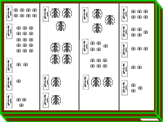
Collection
235 specimens in author's collection
Datas on labels
- Hispaniola, Rép. Dominicaine, Bayahibe, Dominicus • 60♂45♀ • 4.5-5.5 mm • vii-2006 • lam.#9448, 9449, 9450, 9451, 9452, 9453, 9454, 9455, 9456, 9457, 9458, 9459, 9460, 9461, 9462, 9463, 9464, 9465, 9466, 9467, 9468, 9469, 9470, 9471, 9472, 9473, 9474, 9475, 9476, 9477, 9478, 9479, 9480, 9503, 9504, 9505, 9506, 9507, 9508, 9509, 9510, 9511, 9512, 9513, 9514, 9515, 9516, 9517, 9518, 9519, 9520, 9521, 9522, 9523, 9524, 9525, 9539, 9540, 9541, 9542, 9543, 9544, 9545, 9546, 9547, 9548, 9549, 9550, 9551, 9552, 9553, 9554, 9555, 9556, 9557, 9558, 9559, 9560, 9561, 9562, 9563, 9569, 9570, 9571, 9572, 9573, 9574, 9575, 9576, 9577, 9578, 9579, 9580, 9581, 9582, 9583, 9584, 9585, 9586, 9587, 9588, 9589, 9590, 9591, 9592
- Hispaniola, Rép. Dominicaine, Bayahibe, Parque del Este, Caseta Guaraguao • 22♂14♀ • 4.5-5.5 mm • vii-2006 • lam.#9481, 9482, 9483, 9484, 9485, 9486, 9487, 9488, 9489, 9490, 9491, 9492, 9493, 9494, 9495, 9496, 9497, 9498, 9499, 9500, 9501, 9502, 9530, 9531, 9532, 9533, 9534, 9535, 9536, 9537, 9538, 9564, 9565, 9566, 9567, 9568
- Hispaniola, Rép. Dominicaine, Las Terrenas, El Portillo • 90lam. dont 5♂1♀ • 4-5.5 mm • ii-2003 • lam.#5896, 5897, 5898, 5899, 6064, 6065, 6066, 6067, 6068, 6069, 6070, 6071, 6072, 6073, 6074, 6075, 6076, 6077, 6078, 6079, 6080, 6081, 6082, 6083, 6084, 6085, 6086, 6087, 6088, 6089, 6090, 6091, 6092, 6093, 6095, 6097, 6098, 6099, 6100, 6101, 6102, 6103, 6104, 6105, 6106, 6107, 6108, 6109, 6110, 6111, 6112, 6113, 6114, 6115, 6116, 6117, 6118, 6119, 6120, 6122, 6123, 6124, 6125, 6126, 6127, 6128, 6129, 6130, 6131, 6132, 6133, 6134, 6135, 6136, 6137, 6138, 6139, 6140, 6141, 6142, 6143, 6144, 6145, 6146, 6147, 6148, 6154, 6155, 6156, 6157
- Hispaniola, Rép. Dominicaine, Saona I. • 1♂3♀ • vii-2006 • lam.#9526, 9527, 9528, 9529